GML is very similar to XML, where we describe the geo position coordinates, type, etc in a standard xml format called as GML.
For this we can find an interface called “IGMLConversion” in “ESRI.ArcGIS.TrackingAnalyst” package.
I have written a tool which look like
 |
I have placed my tool with caption as “GIS Demos”, so you can find “GIS Demos” button in Arc map interface while importing this .tlb file.
 |
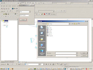
Now if we click on the export button by selecting a feature layer name populated in the drop down list,
 |
As soon as I provide a file name and say “save” in the file dialog.
It generates GML string for all available features in the selected feature layer and writes them to the file name provided and opens the same file.
 |
No comments:
Post a Comment